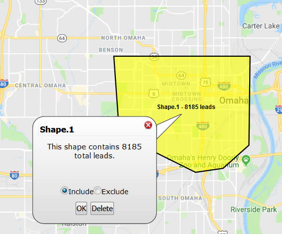
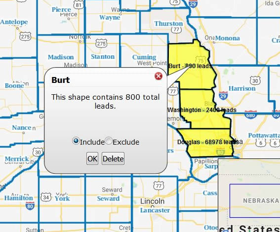
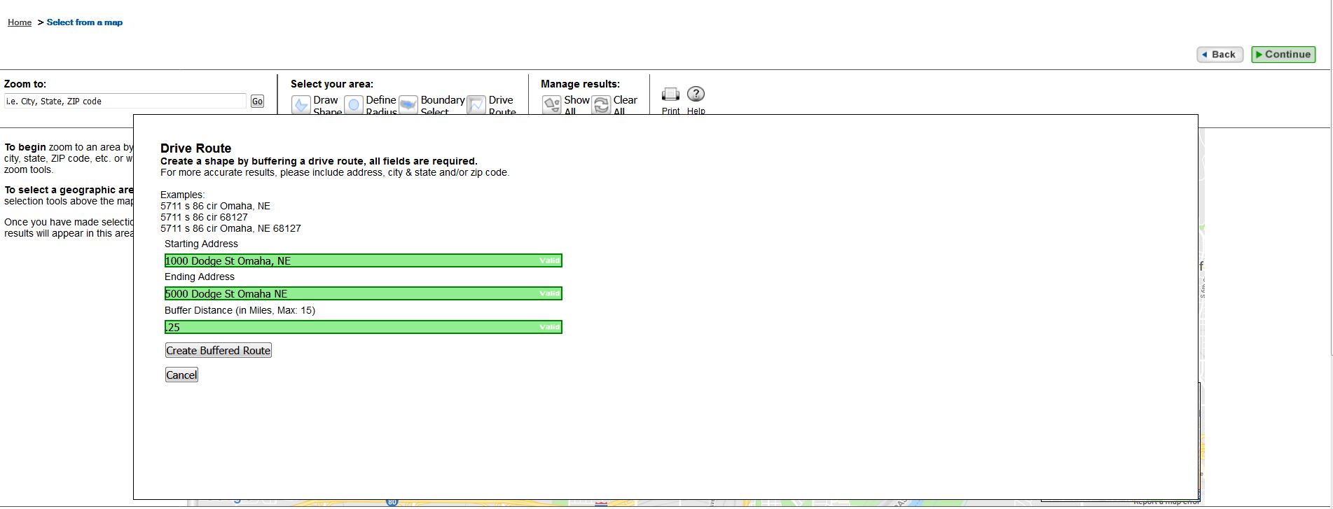
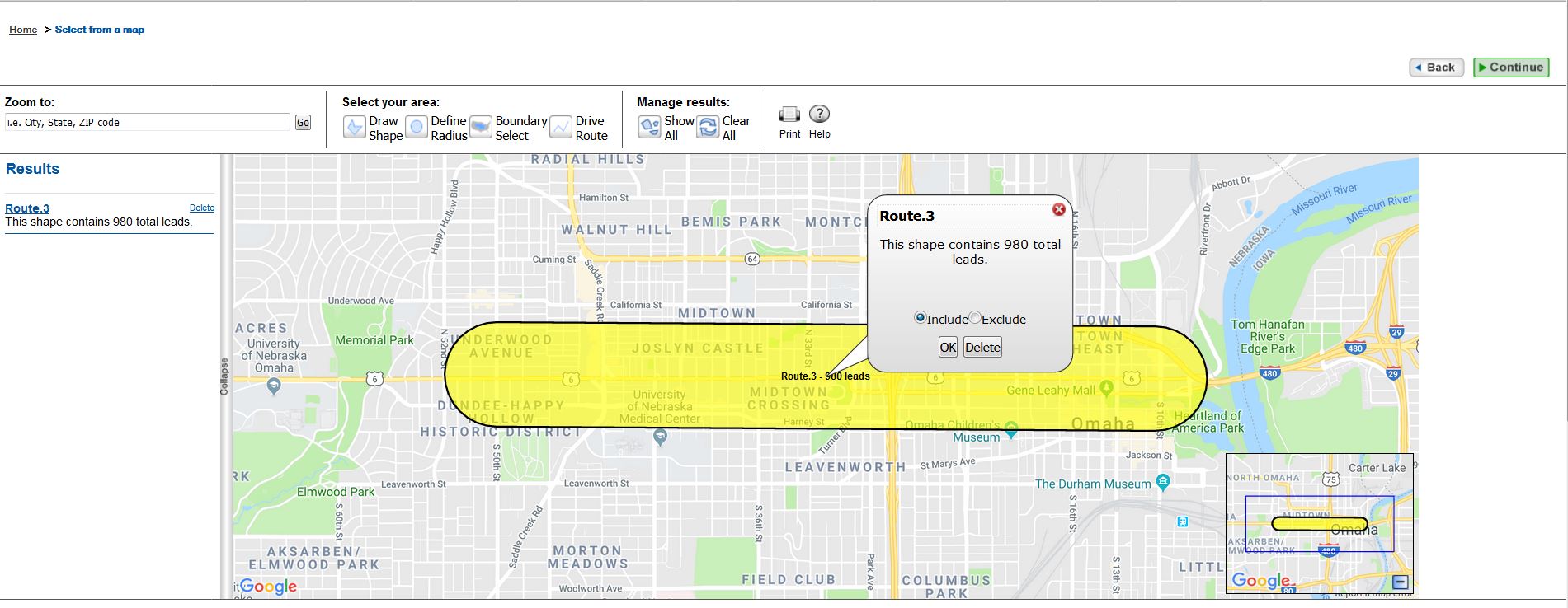
The business owner of infoUSA.com wanted customers who were building their lists to be able to use a map to select the geographic region they wanted to target. I worked with the product manager, a product analyst, several members of the development team over a six-month time-frame. While priority was given to a customer’s ability to draw a custom shape, business requirements also specified customers should be able to select by geographical region, create a radius and enter starting and ending points for a drive route. I created mockups, performed user testing and provided graphical elements.